Attapeu is not a dynamic, crowded province, but a place to impress visitors with cultural places. Here are the places you can not miss when visiting Attapeu.
Temples
Laos is famous as the land of Buddism, so there are many temples in Laos. Visit one of Attapeu’s few Buddhist Temples. Vat Pha Saysettha and Stupa is the most renowned and is easy to reach from Attapeu Town. The religious site was built in 1577 in honour of Lane Xang King Sayasetthathirath, who died nearby.
Ancient Vat Sakhae houses the sacred Buddha image of Ongsene. Even older stands Kavanghine Place, a rock structure in Phouvong believed to have been constructed during the legendary Muang Chueng era.
Lake and waterfall
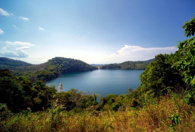
Nong Fa Lake

Located a 3-day walk from Sanxay District in the northeast of Attapeu. Situated amid serene natural beauty and fenced by peaks of mountains. This virgin lake has all year round sky blue water.
Tad Saephe Waterfall
This waterfall is located in Xepaine Forest is 61 kilometers from Samakkhixay District. 23 meters height and 120 meters width.
Attapeu Ecotourism

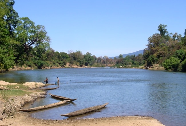
The province of Attapeu is known for its rivers, namely the Xe Kong, Xe Kaman and Xe Xou rivers. You can travel the Xe Kong River along the border of Cambodia and then up the Xe Pian River to access Xe Pian National Protected Area. A remote and little known crater lake, called Nong Fa, the largest crater lake (and perhaps the only one) in the country, has beautiful clear waters and is surrounded by pine forests. The eastern slopes of Bolaven Plateau in Attapeu are heavily forested and support various wildlife species; much of the forests are protected by provincial protected areas.
Dong Amphan Protected Area
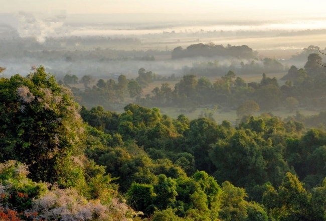
Access is mainly limited to dry season only. The lowland evergreen, semi-evergreen, is mixed with deciduous and dry dipterocarp forests. Coniferous and broadleaf woodland, hill evergreen and semi-evergreen and fagaceous forests. Dong Amphan is situated in the Annamite Chain that runs along the Lao and Vietnamese border. These mountains are steep and rugged and give rise to numerous streams and rivers, which create small floodplain areas. The Nong Fa or crater lake is situated within the boundaries of the NPA. Elevation ranges from ca.120m to 2,052 m at Phou Pengmun. This protected area is also home of Douc langur and buff-cheeked , gibbon,fishing cat Asiatic golden cat, clouded , leopard and tiger. Gaur, Trong Song muntjac and small populations of Asian elephants. There are a total of 280 bird species including Siamese fireback, crested argus and the woolly-necked stork & rufous-winged buzzard.
Pottery In Ban Thahine
Different families in Ban Thahine perform all stages of the pottery making process from collecting the earth to firing and glazing the vases. The tradition of producing pottery has been carried on for generations and the vases serve various purposes; the larger ones for holding water and the smaller vases are often used for holding Lao hai, a traditional alcoholic rice beverage. The glazes used for decorating and coloring the pots are produced from natural forest products, usually a mixture of leaves and ashes that are applied to the pottery before firing, which leave beautiful hues and designs on the finished product.
Xe Pian Protected Area

The Xe Pian Protected Area covers a part of Attapeu and Champasak Provinces. The main access is by road No. 13 running from China to Cambodia. South of Pakse at Km. 48 route No. 6 crosses, running east along the northern boundary of the NBCA. The major wide life in this area includes Tiger, banteng, irrawaddy, dolphin, Asian elephant, gaur, sun bear, Asiatic black bear, yellow-checked crested gibbon. The Xe Pian-Dong Hua Sao NPA gibbon population is of major global conservation significance. Xe Pian has the highest number of birds recorded for any NPA. Seven of these species have not been recorded in any other protected area in Laos. Important species include the giant ibis, black ibis, sarus crane, white-winged duck and the white rumped, long billed and red headed vulture. The forest types include evergreen, mixed-evergreen and deciduous. Terrain is hilly and low with extensive areas of flat lands in the east and south at an altitude of 150 – 300 m. The Xe Kong plains in the east are dissected by three main rivers – the Xe Pian, Xe Khampho and near the northern and eastern perimeters.Xe Kong and contain numerous mainly seasonal wetlands. Drainage is largely south to Cambodia and north to the northern wetlands.


